Hiking in Portugal: The Best Trails by Region and Season

Rintsje Bosch
Rintsje Bosch
Rintsje Bosch
01 Oct 2026 • 14 min read
Hiking in Portugal: The Best Trails by Region and Season
Trekking experts per destination
Free cancellation up to eight weeks in advance
Quick personal advice

Hiking in Portugal is rewarding almost any time of year — except summer, when the southwest coast bakes under a fierce Atlantic sun and the Algarve interior offers next to no shade. Spring, autumn and winter are Portugal's real hiking seasons, precisely when the Alps are either shut or snow-covered and the Pyrenees are still cold. That makes it an ideal destination for British and American walkers looking for a long-distance trail outside the crowded summer months.

Portugal has five distinct hiking landscapes: the wild Atlantic coastline of the southwest, the quiet cork-oak hills and white villages of the Algarve interior, the subtropical levada network of Madeira, the volcanic island trails of the Azores, and the ancient pilgrimage routes of the north. On our multi-day routes, we arrange your accommodation in advance, add luggage transport wherever the route allows, and give you the Bookatrekking app with an offline GPS track per stage. Browse all our walking trips in Portugal or read on for the honest, region-by-region guide.

Hiking in Portugal: is it good, and which region suits you?

Yes, Portugal is an excellent hiking destination, and it is consistently underrated. Large sections of the southwest coast fall inside a protected natural park, so the kind of mass-tourism development that has changed other European coastlines simply has not happened here. The interior is sparsely populated. The Atlantic islands have trails through landscapes that exist nowhere else in Europe. And outside the summer heat, the climate suits walking for much of the year.

Here is a quick map of the five regions and what they offer:

The southwest coast runs from Porto Covo down to Lagos along one of the last truly wild stretches of the European Atlantic. The Fisherman's Trail follows the entire length through clifftops, dunes, and fishing villages. It is the most famous hiking trail in Portugal. See the full section below.

The Algarve interior is a different world from the beach resorts. The Via Algarviana (GR13) crosses the hills inland, from the Spanish border to Cabo de São Vicente, through cork oak forests, olive groves and quiet villages that most tourists never reach. It connects to the Fisherman's Trail at the coast, making a long through-hike possible. See the Via Algarviana section below.

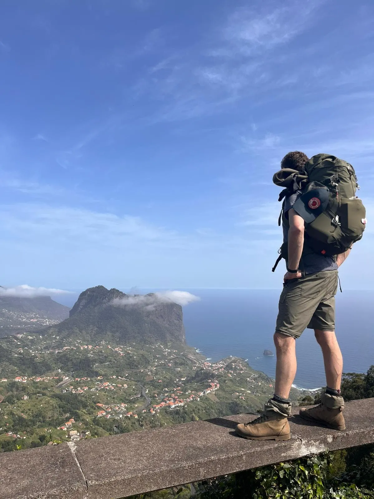
Madeira is a subtropical island roughly 1,000 km southwest of Lisbon, where the land rises steeply from the ocean to Pico Ruivo at 1,862 m. The islanders built a dense network of levadas (irrigation channels with paths alongside) and veredas (old mountain tracks) to connect coast and summit. The Madeira Trail crosses the entire island in five days. See the Madeira section below.

The Azores sit in the middle of the Atlantic Ocean, formed by active volcanoes. The archipelago is home to the highest point in Portugal: Pico, at 2,351 m. It also holds the only hut-to-hut trekking route in the country, the Grande Rota de Santa Maria on the island of Santa Maria. See the Azores section below.

The north is the place to walk if the Camino Portugués is on your list. The full route runs 621 km from Lisbon via Porto to Santiago de Compostela in Spain. Most walkers join for the last 100 km from Tui, which is just across the border in Spain, and that is what earns you the Compostela certificate. Read our Camino Portugués guide for the full picture, or go straight to our Camino Portugués from Tui to Santiago. In the northeast, the GR22 follows a chain of historical villages and medieval castles along the Portuguese-Spanish border, worth noting if you are planning a longer Portugal itinerary.

Portugal hiking trails at a glance

Route Region Days Distance Level
Fisherman's Trail (Full) Southwest coast 13 218.9 km (136 mi) Intermediate
Fisherman's Trail (Northern Half) Southwest coast 7 95.8 km (60 mi) Intermediate
Fisherman's Trail (Southern Half) Southwest coast 8 123.1 km (76 mi) Intermediate
Via Algarviana (Loulé to Silves) Algarve interior 7 101.5 km (63 mi) Intermediate
Madeira Trail Madeira 5 81.5 km (51 mi) Intermediate, demanding
Grande Rota de Santa Maria Azores 5 71.3 km (44 mi) Intermediate
Camino Portugués (Tui to Santiago) North 8 122.5 km (76 mi) Intermediate

See all available departures and packages on our walking trips in Portugal page.

Hiking in Portugal: is it good, and which region suits you?

Book Now

Madeira Trail
Madeira Trail
636

Madeira Trail

Welcome to Madeira, an island paradise in the Atlantic Ocean and a trekker’s dream. Join us on the Madeira Trail, a demanding route that crosses the island in less than a week. With long stages, steep climbs, and tough descents—including Madeira’s highest peak, Pico Ruivo—this trek is best suited for intermediate hikers with a solid level of fitness.
  • 6 h 49m /day
  • 17 km / 11 mi /day
  • +896 m / +2940 ft /day
  • -1212 m / -3976 ft /day
636

Intermediate

Our most loved adventures
Madeira Trail - Including Hotel Before and After + Luggage Transport
983

Madeira Trail - Including Hotel Before and After + Luggage Transport

Discover Madeira on foot, from coast to coast. The Madeira Trail is a multi-day hiking adventure through rugged mountains, ancient walking paths and past the island’s highest peak, Pico Ruivo. This route is perfect for hikers with a good basic level of fitness: expect long hiking days, steady climbs and challenging descents. To make things a little easier, your overnight stays before and after the trek are already arranged, and your luggage is transported from accommodation to accommodation. This means you only hike with a light daypack and can fully enjoy the nature, the views and the adventure, without having to carry everything yourself.
  • 6 h 49m /day
  • 17 km / 11 mi /day
  • +896 m / +2940 ft /day
  • -1212 m / -3976 ft /day
983

Intermediate

Our most loved adventures
Grande Rota de Santa Maria
607

Grande Rota de Santa Maria

The Azores is a hiker's delight! The jewel in the crown is the Grande Rota de Santa Maria, an epic 5-day hike from hut to hut around the island of Santa Maria.
  • 5 h 20m /day
  • 14.3 km / 9 mi /day
  • +462 m / +1516 ft /day
  • -464 m / -1522 ft /day
607

Intermediate

Our most loved adventures

The Fisherman's Trail: Portugal's most famous coastal hike

The Fisherman's Trail is the coastal section of the Rota Vicentina trail network, and it runs entirely through the Southwest Alentejo and Vicentine Coast Natural Park. The path was originally used by local fishermen to reach remote coves and cliff-top fishing spots, and those same sandy tracks are now one of the best long-distance walking trails on the continent.

The trail runs from Porto Covo in the north to Lagos in the south, passing sea stacks, deserted beaches, dramatic headlands, and small fishing villages where not much has changed in decades. One honest note on difficulty: the trail has relatively modest elevation gain, but more than half the surface is sand. Soft coastal sand is tiring in a way that mountain terrain is not, and on many stages there is no café or shop between start and finish. Carry your lunch and enough water every day.

The trail is available in three formats, all of which include accommodation and luggage transport between stops:

The Full Fisherman's Trail covers the entire route in 13 days and 11 stages, 218.9 km (136 mi) from Porto Covo to Lagos, averaging 19.9 km and 285 m of ascent per day. It is the definitive long-distance walking experience on the Portuguese coast.

The Northern Half runs 7 days and 5 stages from Porto Covo to Aljezur, 95.8 km (60 mi), through long dune beaches and river estuaries. A note for those searching for a shorter version: the original Rota Vicentina itinerary began as four stages from Porto Covo to Odeceixe. Our Northern Half extends that into a five-stage route to Aljezur, which is a fuller and more satisfying experience. We do not offer a standalone four-day itinerary.

The Southern Half runs 8 days and 6 stages from Aljezur to Lagos, 123.1 km (76 mi), averaging 352 m of ascent per day, which makes it noticeably rougher than the north. This is where hiking in the Algarve coast gets dramatic: rugged sea cliffs, Cabo de São Vicente at the most south-westerly point of the European mainland, Sagres, and the cliffs at Ponta da Piedade near Lagos as a spectacular finish.

For a complete stage-by-stage breakdown of the route, read our guide to walking the Fisherman's Trail.

The Fisherman's Trail: Portugal's most famous coastal hike

Via Algarviana: hiking in Portugal's Algarve, away from the coast

Most people who have been to the Algarve know the beach resorts. The Via Algarviana (GR13) goes in the opposite direction, slicing inland from Alcoutim on the Spanish border all the way to Cabo de São Vicente, where it meets the Fisherman's Trail on the cliffs. The full route covers roughly 300 km in 14 stages.

The landscape shifts as you walk west. The eastern section crosses the Serra do Caldeirão, a range of hills covered in cork oak. Villages like Querença, Salir and Alte feel entirely removed from the coastal tourist economy: narrow streets, whitewashed houses, and slow café mornings. Further west, beyond our section, the full route rises toward the Serra de Monchique, where Fóia and Picota are the highest summits of the Algarve. The town of Silves, with its Moorish hilltop castle, makes a fitting endpoint for a week of walking.

Our packaged route, the Via Algarviana from Loulé to Silves, covers 101.5 km (63 mi) across 6 walking stages in 7 days, averaging 16.9 km per day. It stays in small guesthouses in the villages along the route, with luggage transported ahead each morning so you walk with a daypack only.

Who is this trail for? Walkers who want the quiet side of Portugal: rural landscapes, local hospitality, and long open views, without the sandy legs and sea wind of the coastal route. Distances are manageable and the terrain is rarely technical.

One note on timing: summer turns the Algarve interior hot and shadeless, and the trail is best avoided in July and August. February to April is the most beautiful window, when the hillsides are in full bloom. Autumn brings rain and a return of green after the summer drought; check the trip page for our departure dates.

For all the stage details, read our full Via Algarviana guide.

Via Algarviana: hiking in Portugal's Algarve, away from the coast

Hiking in Madeira: levadas, veredas and the Madeira Trail

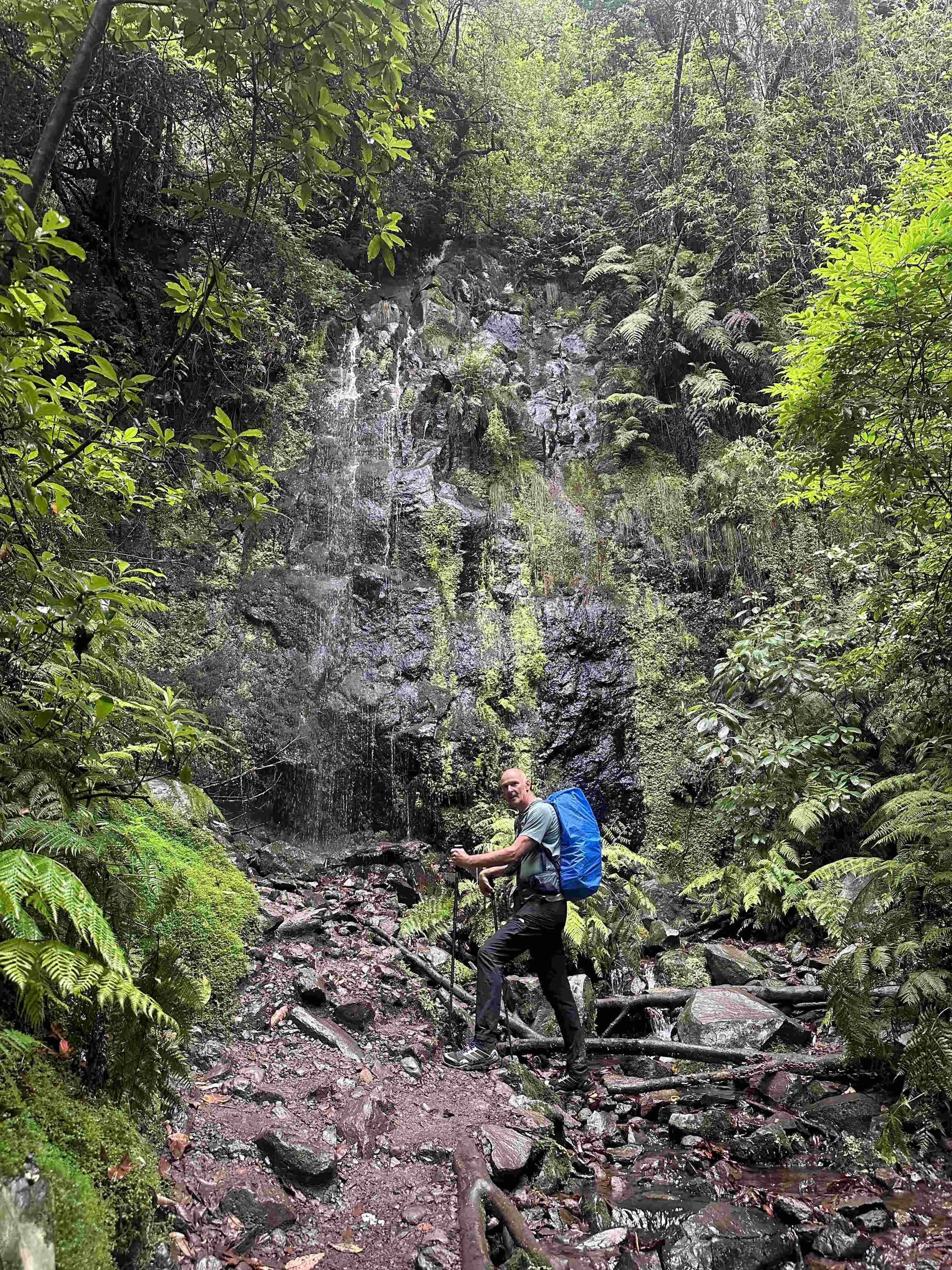
Madeira is a subtropical island rising steeply out of the Atlantic Ocean, roughly 1,000 km southwest of Lisbon. From the narrow coastal strip the land climbs almost immediately to Pico Ruivo at 1,862 m, and the Madeiran islanders have spent centuries engineering their way through this terrain. Levadas are narrow irrigation channels, built to carry water from the wet northern slopes to the drier south, with paths running alongside them for maintenance access. Veredas are old mountain paths across the high ground. Together with the ancient laurisilva laurel forest, a UNESCO World Heritage Site, they make Madeira one of the most distinctive walking destinations on the planet.

The Madeira Trail crosses the island in 5 days, 81.5 km (51 mi), from Machico in the east to Ribeira da Janela in the northwest, with a summit day up Pico Ruivo at 1,862 m, the highest point on the island. Total ascent for the five days is about 4,460 m, an average of almost 900 m of climb per day, which makes this the most demanding route on this page.

Be honest with yourself before booking it. The paths are steep and rocky, and after rain they become slippery and muddy. Levadas can overflow after heavy precipitation, making sections wet underfoot. One stage includes a tunnel stretch, so bring a headlamp. The trail is self-supported: you carry your own pack throughout. A separate version with hotel accommodation before and after the trek and luggage transport between stops is also available, which takes some of the pressure off.

Madeira is walkable year-round. April and May bring mild temperatures and good trail conditions after the winter rains. September and October typically offer the clearest visibility for the ridge sections. In January and February, snow is possible on the highest peaks, and the high route requires extra caution. Always check current conditions before setting off.

For a full guide to Madeira's trails, levadas, and the trail booking system in place since 2026, read our complete Madeira hiking guide.

Hiking in Madeira: levadas, veredas and the Madeira Trail

Grande Rota de Santa Maria: hut-to-hut hiking in the Azores

The Azores are the western edge of Europe: volcanic islands rising from the mid-Atlantic. For American walkers in particular, the Azores feel genuinely halfway to home. The archipelago offers craters, volcanic cones and coastal paths, on islands such as Faial and Corvo and on summits such as Pico da Varda. Pico, the island named after its volcanic cone, holds the highest point in Portugal at 2,351 m, with a short scramble to the summit. For a full overview of hiking across the islands, see our guide to hiking in the Azores.

The centrepiece of any organised hiking trip to the Azores is the Grande Rota de Santa Maria, the only hut-to-hut trekking route in Portugal. Santa Maria is the driest of the Azores islands, receiving less than 750 mm of rainfall per year, which gives it a different character from the other islands.

The route is a five-day circular trek, 71.3 km (44 mi) with 2,310 m of total ascent, starting and finishing in Vila do Porto. Each day ends at a converted stone barn with half-board accommodation, so there is no tent to carry and no logistics to manage at the end of a long stage. The trail passes Malbusca, Lapa and Norte, always returning to views of the Atlantic. The village of São Lourenço sits between some of the steepest sea cliffs on the island, and the climb to Pico Alto at 588 m, the island's high point, gives a full panorama of the route below. The beaches on Santa Maria include both black volcanic sand and white sand.

The season for the Grande Rota de Santa Maria runs broadly from April to October. Departures and exact dates are listed on the trip page.

Grande Rota de Santa Maria: hut-to-hut hiking in the Azores

When is the best time for hiking in Portugal? Region by region

The short answer: spring and autumn on the mainland, almost any time on Madeira, and late spring through summer on the Azores. Portugal's hiking seasons fit neatly into the gaps in the European Alpine calendar, which is one of the strongest reasons for British and American walkers to choose it.

Spring (March to May) is the finest window for coastal and Algarve walking. Wildflowers line the clifftops of the Fisherman's Trail, the Algarve interior is in bloom from February into April, and conditions are comfortable for long stages. Around Easter, coastal accommodation books up quickly.

Summer (June to August) brings intense heat to the mainland with very little shade on the coast or inland trails. The Fisherman's Trail and Via Algarviana are not recommended in the height of summer. The Azores, by contrast, are at their driest and sunniest, making summer the best season for the Azores.

Autumn (September to November) is quietly one of the best times for Portugal hiking. The trails are calm, the sea is still warm from the summer, and Madeira typically has its clearest visibility of the year in September and October. Some rain returns to the mainland in November, but the landscape turns green again after the dry summer.

Winter (December to February) is mild on the coast, with short days, occasional Atlantic rain and strong winds off the ocean, and quiet trails with very few other walkers. Snow is possible on the highest peaks of Madeira in January and February. The Azores are at their wettest in winter.

Best months for hiking in Portugal

Region Best months Approach with caution
Southwest coast (Fisherman's Trail) March to May, September to November June to August
Algarve interior (Via Algarviana) February to April, autumn June to August
Madeira April to May, September to October January to February (high route)
Azores (Santa Maria) May to September Winter

Departure dates vary by route and year. Always check the current availability on the individual trip page. Once you are on the trail, the Bookatrekking app shows the current weather forecast based on the exact coordinates of your accommodation for each stage, which is the most practical way to plan your days on the move.

When is the best time for hiking in Portugal? Region by region

How to reach the trailhead, and FAQs about hiking in Portugal

Portugal is well connected from both sides of the Atlantic. Lisbon is the main international hub; for the Algarve, Faro in the south is the logical arrival point.

Getting to individual trailheads is straightforward. Porto Covo, the northern start of the Fisherman's Trail, is served by Rede Expressos buses from Lisbon, making it the most accessible long-distance starting point for walkers flying into the capital (and the nearest multi-day trail start for anyone looking for hiking near Lisbon within our portfolio). Lagos, the southern finish, has regular bus and train connections to Faro and Lisbon. Aljezur is reachable by bus. Silves, the end of our Via Algarviana section, connects to Faro by bus and train. On Santa Maria in the Azores, both the airport and the port are close to the start and finish of the Grande Rota de Santa Maria. On Madeira, a taxi to the trailhead is usually the most practical option. Please note that travel to the trailhead and onward from the finish is not included in any of our packages.

Frequently asked questions

Is Portugal good for hiking?

Portugal is an excellent hiking destination. The southwest coast is one of Europe's last truly wild Atlantic coastlines, the Algarve interior is quiet and authentic, Madeira has a world-class levada and mountain trail network, and the Azores offer volcanic island trails with hut accommodation. The biggest advantage for British and American walkers is the season: spring, autumn and even winter are all good times to walk here.

What is the most famous hiking trail in Portugal?

The Fisherman's Trail is widely regarded as the most famous hiking route in Portugal. It runs along the wild Atlantic coastline from Porto Covo to Lagos and is the defining long-distance coastal trail in the country. Read our complete Fisherman's Trail guide for all stage details. The Camino Portugués is the best-known multi-country route, linking Portugal to Santiago de Compostela in Spain.

Is there a 4-day trek along the Fisherman's Trail?

The original Rota Vicentina itinerary was mapped as four stages from Porto Covo to Odeceixe. Our shortest version extends that into a seven-day, five-stage trip to Aljezur, which we call the Northern Half. We do not offer a standalone four-day package on the Fisherman's Trail.

Is the Fisherman's Trail in Portugal safe?

Yes. The route is well marked throughout, and the terrain involves no serious technical climbing or extreme exposure. The main hazards are soft sand, which is tiring and can twist an ankle, and the cliff-edge sections in the south, which require attention. Stay on the marked path, carry enough water for each full stage, and avoid walking in the midday heat in warmer months. On wide open beaches where marker posts are spaced far apart, the offline GPS track in the Bookatrekking app makes navigation straightforward.

What is the best season for hiking in Portugal?

Spring (March to May) and autumn (September to November) are the best seasons for walking on the Portuguese mainland. For Madeira, April to May and September to October are ideal. The Azores are best from May to September. Winter is possible on the coast and in Madeira, with shorter days and occasional rain; summer is hot on the mainland and best avoided on the Fisherman's Trail and Via Algarviana.

Can you go winter hiking in Portugal?

Yes, particularly along the coast and on Madeira. Coastal trails in winter offer mild temperatures, empty paths and dramatic Atlantic light, though you should be prepared for rain and strong winds. On Madeira, the highest peaks can see snow in January and February. Check departure dates and conditions on the trip page before booking a winter visit.

Where to stay in Portugal for hiking?

On the Fisherman's Trail and Via Algarviana, accommodation is in guesthouses and small hotels in the villages along the route. On the Madeira Trail, you stay in small hotels, inns and guesthouses surrounded by forest and mountains. On the Grande Rota de Santa Maria, you sleep in converted stone barns with half-board included. On the Camino Portugués, you stay in cosy hotels and pensións. With Bookatrekking, all accommodation is arranged in advance.

What are the best multi-day hikes in Portugal?

The five standout multi-day routes are: the Fisherman's Trail (13 days, wild Atlantic coastline), the Via Algarviana (7 days, quiet Algarve interior), the Madeira Trail (5 days, demanding mountain traverse), the Grande Rota de Santa Maria (5 days, hut-to-hut island circuit), and the Camino Portugués from Tui to Santiago (8 days, pilgrimage). See all available options on our walking trips in Portugal page.

Can you go hiking in Portugal near Lisbon?

The nearest multi-day trailhead in our portfolio is Porto Covo, the northern start of the Fisherman's Trail, reached by bus from Lisbon. The Camino Portugués also begins in Lisbon, though most walkers join the route for the final 100 km from Tui.


How to reach the trailhead, and FAQs about hiking in Portugal

Safety tips for the Portugal

Although this is far from being a trek in the Himalayas, unexpected things can always happen and you might also find obstacles on the hiking trails along the way. The Portugal is safe, the trails are quite straight forward and there is not an extreme difference in altitude. However, for your safety, every hike deserves a level of respect; respect for the terrain, the trails, wildlife and vegetation, local rules and regulations, and above all, your physical capabilities and safety. Therefore, for an unforgettable and safe hiking memory, please keep the following safety recommendations in mind:

  • Know your limits

    Always prepare each stage carefully to use your energy wisely, respect your physical and mental limitations, and avoid taking unnecessary risks. When ascending or descending, if applicable, always use the aids provided, such as handrails and ropes. Is this trek suitable for you? Well, familiarize yourself with the grading system and figure out if this trek matches your capabilities. If you still need professional advice you can always contact Bookatrekking.com experts.

  • Stay on marked trails

    The most important thing is to never leave the marked paths. For easy navigation, most of our treks come with the Bookatrekking app: it shows your route for each day and your own position on the map, and once downloaded, everything also works offline. As a backup, make sure to bring a hiking guide or a paper map with you.

  • Fully equipped

    Make sure you have the necessary gear for the conditions you'll be facing, including appropriate clothing, footwear, and any necessary equipment for the terrain you'll be hiking on. Always wear clothing adapted to the weather of Portugal and protect yourself from cold and wetness or heat and sun. Besides, make sure you carry enough food and water for the duration of your trek. On the way, you might (or might not) be able to buy snacks.

  • Stay reachable

    If you are hiking solo or in small groups it is advisable to inform people back home about your plans, what route you are taking and when you plan to return. Even small incidents can lead to unpleasant emergencies so make sure you are available at all times. Bring a charged phone containing at least the phone numbers of immediate family members, your accommodations en route and the emergency phone numbers operating in the Portugal.

  • Respect for nature

    Do not litter, prevent noise, stay on the marked trails, do not disturb wildlife or grazing animals, and respect protected areas.

Where Can I Book My Walking Adventure in Portugal?

At Bookatrekking.com you can book many treks in Portugal. We take care of all the details for you, give you personal trekking advice and give you the best service possible. Find all our offers for Portugal here. Our easy-to-use platform allows you to browse and compare different trekking options and find the perfect fit for your interests, abilities, and budget.

If you have any questions about a specific trek or need help choosing the right one for you, our team of Trekking Experts is here to assist you. Simply reach out to us and we will be happy to provide you with personalized recommendations and advice to help you plan the trekking adventure of a lifetime.

About Us

At Bookatrekking.com, you will find the trek that will make your life unforgettable. Whether you want to explore the Inca Trail or climb Kilimanjaro. Bookatrekking.com has a wide and varied range of first-class treks. No false promises are made here. Transparent prices and bookings are fixed instantly. Find, compare, book and trek!
Read more about us
About Us
About Us

Also Interesting